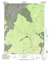
1995 Map of Paddy Knob
USGS Topo · Published 1998About this map
Paddy Knob stands as a prominent landmark on the high border between West Virginia and Virginia, anchoring a landscape defined by the intersection of the Monongahela National Forest and the George Washington National Forest. The 1990s terrain reveals a complex network of ridges, including Gregory Ridge and Sheep Ridge, which divide numerous watercourses like Knapp Creek and Sitlington Creek. This era shows the continued significance of high-country recreation and timber management within the Huntersville District.
Find a feature on this map
73 named features on this map. Tap any name to fly to it.
Don’t see what you’re looking for? This feature index may not catch every label — zoom into the map to look around manually.
Map Details
Editions of this 1995 Paddy Knob Map
This is the sole edition of this map. No revisions or reprints were ever made.
Other maps of this area

1901 · Monterey
USGS Topo · 1:125,000

1922 · Cass
USGS Topo · 1:48,000

1923 · Warm Springs
USGS Topo · 1:48,000

1924 · Cass
USGS Topo · 1:62,500

1926 · Warm Springs
USGS Topo · 1:62,500

1941 · Monterey
USGS Topo · 1:62,500

1944 · Monterey
USGS Topo · 1:62,500

1946 · Warm Springs
USGS Topo · 1:62,500

1946 · Williamsville
USGS Topo · 1:62,500

1949 · Charlottesville
USGS Topo · 1:250,000