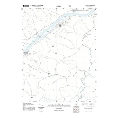
2011 Map of Paden City
USGS Topo · Published 2011About this map
Paden City and Sistersville anchor this stretch of the Ohio River, where industrial and residential development clings to the narrow riverbanks below high ridges. The landscape is defined by the steep drainage of the Appalachian foothills, where numerous runs and creeks like Pursley Creek and Point Pleasant Creek have carved deep hollows. Several small islands and river features, including Paden Island, Williamson Island, and the Witten Towhead, illustrate the navigational character of the river before modern channelization.
Find a feature on this map
110 named features on this map. Tap any name to fly to it.
Don’t see what you’re looking for? This feature index may not catch every label — zoom into the map to look around manually.
Map Details
Editions of this 2011 Paden City Map
This is the sole edition of this map. No revisions or reprints were ever made.
Other maps of this area

1905 · West Union
USGS Topo · 1:62,500

1905 · New Matamoras
USGS Topo · 1:62,500

1906 · Saint Marys
USGS Topo · 1:62,500

1906 · New Martinsville
USGS Topo · 1:62,500

1924 · St Marys
USGS Topo · 1:62,500

1924 · New Martinsville
USGS Topo · 1:62,500

1924 · New Matamoras
USGS Topo · 1:62,500

1924 · West Union
USGS Topo · 1:62,500

1926 · New Martinsville
USGS Topo · 1:62,500

1926 · New Matamoras
USGS Topo · 1:62,500