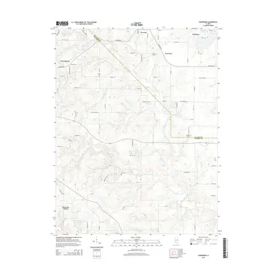
2015 Map of Paderborn
USGS Topo · Published 2015About this map
Floraville and Paderborn sit at the center of this rural Illinois landscape, where the rolling agricultural fields are divided by the winding path of Prairie du Long Cr. The map reflects a deeply rooted community structure, defined by family-named roadways and several historic burial grounds, including Saint Michaels Cem and Martini Cem. While the eastern edge of Waterloo shows signs of modern residential growth, much of the area remains dominated by farm tracts and drainage networks like Rockhouse Cr and Gerhardt Cr.
Find a feature on this map
76 named features on this map. Tap any name to fly to it.
Don’t see what you’re looking for? This feature index may not catch every label — zoom into the map to look around manually.
Map Details
Editions of this 2015 Paderborn Map
This is the sole edition of this map. No revisions or reprints were ever made.
Other maps of this area

1910 · Waterloo
USGS Topo · 1:62,500

1912 · New Athens
USGS Topo · 1:62,500

1912 · Baldwin
USGS Topo · 1:62,500

1913 · Waterloo
USGS Topo · 1:62,500

1914 · Baldwin
USGS Topo · 1:62,500

1915 · Renault
USGS Topo · 1:62,500

1940 · Renault
USGS Topo · 1:62,500

1942 · Baldwin
USGS Topo · 1:62,500

1949 · Saint Louis
USGS Topo · 1:250,000
1951 · Columbia
USGS Topo · 1:24,000