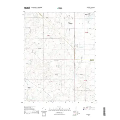
2018 Map of Paderborn
USGS Topo · Published 2018About this map
Paderborn and the surrounding rural landscapes of Monroe and St. Clair counties are documented in this 2018 topographic survey. The area is characterized by a network of small creeks including Prairie du Long Cr and Rockhouse Cr, which carve through the farmland between the larger settlements of Waterloo and Smithton. This map highlights several long-standing local landmarks, including the Saint Michaels Cem in Paderborn and the Martini Cem located further west near Kopp Cr.
Find a feature on this map
85 named features on this map. Tap any name to fly to it.
Don’t see what you’re looking for? This feature index may not catch every label — zoom into the map to look around manually.
Map Details
Editions of this 2018 Paderborn Map
This is the sole edition of this map. No revisions or reprints were ever made.
Other maps of this area

1910 · Waterloo
USGS Topo · 1:62,500

1912 · New Athens
USGS Topo · 1:62,500

1912 · Baldwin
USGS Topo · 1:62,500

1913 · Waterloo
USGS Topo · 1:62,500

1914 · Baldwin
USGS Topo · 1:62,500

1915 · Renault
USGS Topo · 1:62,500

1940 · Renault
USGS Topo · 1:62,500

1942 · Baldwin
USGS Topo · 1:62,500

1949 · Saint Louis
USGS Topo · 1:250,000
1951 · Columbia
USGS Topo · 1:24,000