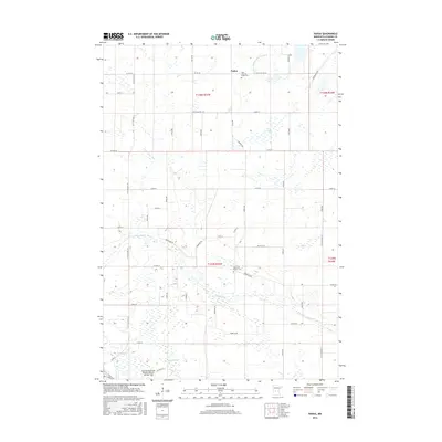
2016 Map of Padua
USGS Topo · Published 2016About this map
Padua sits at the heart of this agricultural landscape in Stearns County, serving as a focal point for the surrounding rural townships. The settlement’s identity is anchored by the Saint Anthony Padua Cem, reflecting the area's deep-rooted community heritage. The terrain is defined by a complex hydrologic network, where the N Fork Crow River and Sedan Brook meander through glacial till, while engineered waterways like County Ditch Number Fortysix illustrate the mid-century efforts to manage local drainage for farming. To the south, the Brooten Municipal Airport/John O. Bohmer Field marks a modern transition in regional transport. In the lower sections of the map, the Skunk River and Big Grove Church Cem provide additional landmarks for genealogists tracing family histories in this part of central Minnesota.
Find a feature on this map
40 named features on this map. Tap any name to fly to it.
Don’t see what you’re looking for? This feature index may not catch every label — zoom into the map to look around manually.
Map Details
Editions of this 2016 Padua Map
This is the sole edition of this map. No revisions or reprints were ever made.
Other maps of this area

1953 · Saint Cloud
USGS Topo · 1:250,000

1957 · Saint Cloud
USGS Topo · 1:250,000

1958 · Saint Cloud
USGS Topo · 1:250,000

1965 · Westport
USGS Topo · 1:24,000

1965 · Sauk Centre
USGS Topo · 1:24,000

1965 · Padua
USGS Topo · 1:24,000

1965 · Sedan
USGS Topo · 1:24,000

1965 · Raymond Lake
USGS Topo · 1:24,000

1965 · Elrosa
USGS Topo · 1:24,000

1967 · Belgrade
USGS Topo · 1:24,000