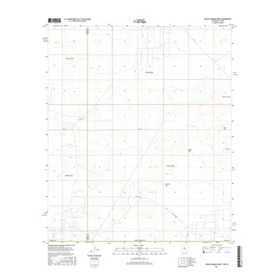
2017 Map of Paduca Breaks West
USGS Topo · Published 2017About this map
Red Hills Draw and Bobcat Draw cut through this arid landscape along the border of Eddy and Lea counties. This 2017 survey shows a region defined by industrial and ranching infrastructure, where water management features like East Tank are vital markers on the desert floor. The terrain is characterized by the Red Hills and a specific landmark noted as Red Hill, rising between the seasonal drainage paths. A network of utilitarian routes, including the prominent Battle Axe Rd and Pipeline Rd, provides access across the townships. The grid-like division of the land into T25S and T26S illustrates the systematic management of this New Mexico backcountry, revealing how resource extraction and livestock grazing have shaped the local geography near the Texas state line.
Find a feature on this map
18 named features on this map. Tap any name to fly to it.
Don’t see what you’re looking for? This feature index may not catch every label — zoom into the map to look around manually.
Map Details
Editions of this 2017 Paduca Breaks West Map
This is the sole edition of this map. No revisions or reprints were ever made.
Other maps of this area

1931 · Orla
USGS Topo · 1:62,500

1954 · Hobbs
USGS Topo · 1:250,000

1954 · Pecos
USGS Topo · 1:250,000

1957 · Pecos
USGS Topo · 1:250,000

1958 · Hobbs
USGS Topo · 1:250,000

1968 · Orla NE
USGS Topo · 1:24,000

1968 · Phantom Banks
USGS Topo · 1:24,000
1968 · Big Sinks
USGS Topo · 1:24,000

1969 · Kyle Ranch
USGS Topo · 1:24,000

1969 · Rudd Draw NE
USGS Topo · 1:24,000