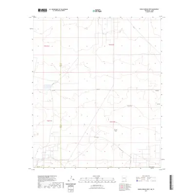
2023 Map of Paduca Breaks West
USGS Topo · Published 2023About this map
Red Hills and the prominent Red Hill rise above the high desert floor of southeastern New Mexico in this contemporary topographic survey. The landscape is defined by its drainage patterns and resource infrastructure, notably the long descent of Bobcat Draw and Red Hills Draw toward the southeast. The border between Eddy and Lea Counties bisects the terrain, revealing a network of remote corridors including Battle Axe Rd and Pipeline Rd. Water management in this arid environment is represented by isolated features like East Tank, providing a critical point of reference for researchers of local land use and ranching history in the Permian Basin region.
Find a feature on this map
18 named features on this map. Tap any name to fly to it.
Don’t see what you’re looking for? This feature index may not catch every label — zoom into the map to look around manually.
Map Details
Editions of this 2023 Paduca Breaks West Map
This is the sole edition of this map. No revisions or reprints were ever made.
Other maps of this area

1931 · Orla
USGS Topo · 1:62,500

1954 · Hobbs
USGS Topo · 1:250,000

1954 · Pecos
USGS Topo · 1:250,000

1957 · Pecos
USGS Topo · 1:250,000

1958 · Hobbs
USGS Topo · 1:250,000

1968 · Orla NE
USGS Topo · 1:24,000

1968 · Phantom Banks
USGS Topo · 1:24,000
1968 · Big Sinks
USGS Topo · 1:24,000

1969 · Kyle Ranch
USGS Topo · 1:24,000

1969 · Rudd Draw NE
USGS Topo · 1:24,000