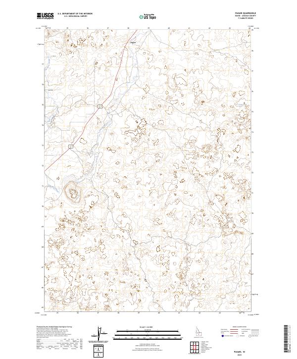
2023 Map of Pagari
USGS Topo · Published 2023About this map
Pagari sits along the upper reaches of the Little Wood River in this arid Lincoln County landscape. The terrain is defined by complex contour patterns and drainage features like Jim Byrns Slough, which mirrors the river's path through the high desert. Local movement is facilitated by a grid of rural routes including Riley Rd and E 1220 N, connecting the settlement of Pagari to the surrounding township sections. Small, isolated water bodies like Crater Lake dot the eastern edge of the quadrangle, highlighting the intermittent nature of water in this volcanic-influenced geography. The map provides a clear record of the intersection between established road networks and the natural watercourses that historically dictated ranching and settlement patterns in this part of Idaho.
Find a feature on this map
12 named features on this map. Tap any name to fly to it.
Don’t see what you’re looking for? This feature index may not catch every label — zoom into the map to look around manually.
Map Details
Editions of this 2023 Pagari Map
This is the sole edition of this map. No revisions or reprints were ever made.
Other maps of this area

1954 · Pocatello
USGS Topo · 1:250,000

1955 · Idaho Falls
USGS Topo · 1:250,000

1955 · Twin Falls
USGS Topo · 1:250,000

1955 · Hailey
USGS Topo · 1:250,000

1958 · Twin Falls
USGS Topo · 1:250,000

1958 · Idaho Falls
USGS Topo · 1:250,000

1958 · Pocatello
USGS Topo · 1:250,000

1959 · Hailey
USGS Topo · 1:250,000

1962 · Hailey
USGS Topo · 1:250,000

1971 · Owinza
USGS Topo · 1:24,000