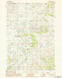
1984 Map of Page Draw
USGS Topo · Published 1985About this map
The Little Missouri River and its North Fork define this high plains landscape along the border of Carter Co, Montana, and Crook Co, Wyoming. During the mid-1980s, the region was characterized by a heavy industrial footprint of mineral extraction, evidenced by the numerous Claypit excavations and Tailings Ponds concentrated near Page Draw. This industrial activity sits alongside a complex drainage network where Lindsey Creek, Bronco John Creek, and Tie Creek feed into the river system. The presence of numerous levees near Cedar Creek and Thompson Creek suggests active water management in this arid grazing and mining territory. This provisional map records the specific geography of these excavations and the natural watercourses like Sage Creek and Scoggin Draw before later land reclamation or further industrial expansion.
Find a feature on this map
16 named features on this map. Tap any name to fly to it.
Don’t see what you’re looking for? This feature index may not catch every label — zoom into the map to look around manually.
Map Details
Editions of this 1984 Page Draw Map
This is the sole edition of this map. No revisions or reprints were ever made.
Other maps of this area

1905 · Devils Tower
USGS Topo · 1:125,000

1954 · Strawberry Hill
USGS Topo · 1:24,000

1954 · Ekalaka
USGS Topo · 1:250,000

1954 · Gillette
USGS Topo · 1:250,000

1955 · Gillette
USGS Topo · 1:250,000

1956 · Ekalaka
USGS Topo · 1:250,000

1957 · Seely
USGS Topo · 1:62,500

1957 · Cedar Ridge
USGS Topo · 1:62,500

1958 · Gillette
USGS Topo · 1:250,000

1958 · Ekalaka
USGS Topo · 1:250,000