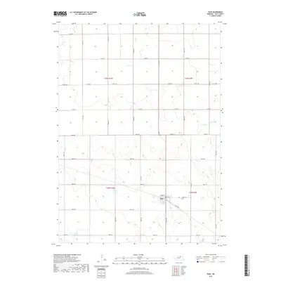
2017 Map of Page
USGS Topo · Published 2017About this map
Page serves as the primary hub for this section of Holt County, situated at the intersection of Main St and Market St. The township-and-range grid system, defined by boundaries like t29n r10w and t28n r9w, organizes the surrounding agricultural landscape into a network of section lines and gravel roads. To the east of the village, the Page Cem sits along the road, while the surrounding terrain is marked by subtle water features including the Middle Br Verdigre Cr and the Chain Lakes in the southwest corner. The road network remains predominantly rural, anchored by Co Hwy 108 and several local routes like Co Rd P168. This survey reflects the enduring structure of Nebraska's farming communities, where the proximity to small local centers and water sources shaped the development of homesteads across the prairie.
Find a feature on this map
29 named features on this map. Tap any name to fly to it.
Don’t see what you’re looking for? This feature index may not catch every label — zoom into the map to look around manually.
Map Details
Editions of this 2017 Page Map
This is the sole edition of this map. No revisions or reprints were ever made.
Other maps of this area

1954 · Dorsey SW
USGS Topo · 1:24,000

1954 · Opportunity
USGS Topo · 1:24,000

1954 · Star
USGS Topo · 1:24,000

1955 · O'Neill
USGS Topo · 1:250,000

1958 · Inman
USGS Topo · 1:24,000

1958 · Page
USGS Topo · 1:24,000

1959 · O'Neill
USGS Topo · 1:250,000

1963 · Ewing SW
USGS Topo · 1:24,000

1963 · Venus
USGS Topo · 1:24,000

1963 · Ewing
USGS Topo · 1:24,000