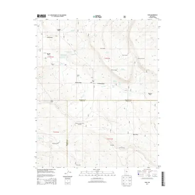
2013 Map of Page
USGS Topo · Published 2013About this map
Basgal Place and Polich Place anchor the high desert ranching landscape of the Zuni Mountains on this 2013 survey. The terrain is defined by the Continental Divide, which separates the drainage of Smith Canyon and Foster Canyon from the lower basins. The map captures a high-altitude agricultural and grazing network, marked by numerous cattle tanks such as Stump Tank and Rim Site Tank that provide vital water in a region where seasonal flows like Rio Nutria and Agua Remora are the primary watercourses. This area, largely within the Cibola National Forest, shows established homesteads including Navarre Place and the Silva Ranch situated along the winding paths of Co RD 50, reflecting the long-standing family ranching traditions along the McKinley and Cibola county lines.
Find a feature on this map
48 named features on this map. Tap any name to fly to it.
Don’t see what you’re looking for? This feature index may not catch every label — zoom into the map to look around manually.
Map Details
Editions of this 2013 Page Map
This is the sole edition of this map. No revisions or reprints were ever made.
Other maps of this area

1886 · Wingate
USGS Topo · 1:250,000

1892 · Wingate
USGS Topo · 1:250,000

1954 · Gallup
USGS Topo · 1:250,000

1958 · Gallup
USGS Topo · 1:250,000

1959 · Gallup
USGS Topo · 1:250,000

1961 · Cottonwood Canyon
USGS Topo · 1:24,000

1962 · Gallup
USGS Topo · 1:250,000

1962 · Ciniza
USGS Topo · 1:24,000

1962 · Continental Divide
USGS Topo · 1:24,000

1962 · Cottonwood Canyon
USGS Topo · 1:24,000