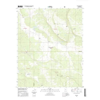
2017 Map of Page
USGS Topo · Published 2017About this map
The Continental Divide winds through this high-altitude landscape in McKinley and Cibola Counties, anchoring a rugged terrain defined by the Zuni Mountains and the Cibola National Forest. The settlement of Page sits centrally, surrounded by a complex system of water management features including Natural Lake, Basgal Tank, and the various Hausner Tanks. This 2017 survey illustrates the enduring reliance on these collection points in an arid environment, where drainage follows paths like the Rio Nutria and through deep incisions such as Nutria Canyon and Smith Canyon. Significant geological and topographical markers, including McKenzie Ridge, Oso Ridge, and the expansive McQue Flat, provide a detailed look at the basin-and-range character of the region. Local infrastructure is represented by a network of unimproved roads like Co Rd 50 and Co Rd 12, which connect the isolated stock tanks and flats throughout the area.
Find a feature on this map
41 named features on this map. Tap any name to fly to it.
Don’t see what you’re looking for? This feature index may not catch every label — zoom into the map to look around manually.
Map Details
Editions of this 2017 Page Map
This is the sole edition of this map. No revisions or reprints were ever made.
Other maps of this area

1886 · Wingate
USGS Topo · 1:250,000

1892 · Wingate
USGS Topo · 1:250,000

1954 · Gallup
USGS Topo · 1:250,000

1958 · Gallup
USGS Topo · 1:250,000

1959 · Gallup
USGS Topo · 1:250,000

1961 · Cottonwood Canyon
USGS Topo · 1:24,000

1962 · Gallup
USGS Topo · 1:250,000

1962 · Ciniza
USGS Topo · 1:24,000

1962 · Continental Divide
USGS Topo · 1:24,000

1962 · Cottonwood Canyon
USGS Topo · 1:24,000