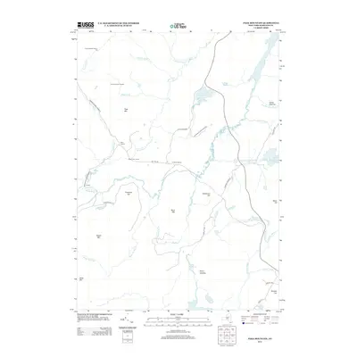
2013 Map of Page Mountain
USGS Topo · Published 2013About this map
Adirondack Park Preserve defines the character of this Hamilton County landscape, where water and wilderness dictate the pattern of human presence. The Miami River and Jessup River wind through a complex network of wetlands and brooks, punctuated by significant water bodies like Mason Lake and the northern reach of Sacandaga Lake. The area's legacy of forestry and seasonal habitation is visible in the naming of remote sites like Indian Clearing, Perrys Clearing, and Perkins Clearing, alongside numbered outposts such as Camp Number Twenty-two. High ground is marked by prominent peaks including Page Mtn, Potash Mtn, and Davis Mtn. Historic transportation routes like Military Rd cut across the drainage basins of Nickel Vly Brook and Whitaker Lake Outlet, reflecting the longstanding tactical and recreational importance of this northern New York territory.
Find a feature on this map
52 named features on this map. Tap any name to fly to it.
Don’t see what you’re looking for? This feature index may not catch every label — zoom into the map to look around manually.
Map Details
Editions of this 2013 Page Mountain Map
This is the sole edition of this map. No revisions or reprints were ever made.
Other maps of this area

1899 · Indian Lake
USGS Topo · 1:62,500

1900 · Canada Lake
USGS Topo · 1:62,500

1902 · Indian Lake
USGS Topo · 1:62,500

1903 · West Canada Lakes
USGS Topo · 1:62,500

1904 · Piseco Lake
USGS Topo · 1:62,500

1906 · Piseco Lake
USGS Topo · 1:62,500

1907 · Lake Pleasant
USGS Topo · 1:62,500

1908 · Piseco Lake
USGS Topo · 1:62,500

1950 · Utica
USGS Topo · 1:250,000

1954 · Lake Pleasant
USGS Topo · 1:62,500