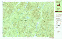
1990 Map of Page Mountain
USGS Topo · Published 1990About this map
The village of Speculator stands at the junction of mountain water and forest, serving as a primary gateway to the central Adirondacks. The landscape is defined by the heavy presence of interconnected waterways, including the Sacandaga River and large bodies of water like Sacandaga Lake and Indian Lake. Notable clearings such as Indian Clearing, Perkins Clearing, and Perry Clearing signify areas of historic land use or settlement within the dense timber of Hamilton County. Dramatic terrain features like Austin Falls and The Rifts on the river systems highlight the natural drainage patterns of the Cross Mountain Range. The map documents a rugged interior geography where small landmarks like a Cem and Gravel Pit appear alongside a modern Snowmobile Trail, reflecting the transition from traditional land use to a recreation-centered economy within the protected lands of Lake Pleasant Adirondack Park.
Find a feature on this map
81 named features on this map. Tap any name to fly to it.
Don’t see what you’re looking for? This feature index may not catch every label — zoom into the map to look around manually.
Map Details
Editions of this 1990 Page Mountain Map
This is the sole edition of this map. No revisions or reprints were ever made.
Other maps of this area

1898 · Thirteenth Lake
USGS Topo · 1:62,500

1899 · Indian Lake
USGS Topo · 1:62,500

1900 · Canada Lake
USGS Topo · 1:62,500

1902 · Indian Lake
USGS Topo · 1:62,500

1903 · West Canada Lakes
USGS Topo · 1:62,500

1904 · Piseco Lake
USGS Topo · 1:62,500

1906 · Piseco Lake
USGS Topo · 1:62,500

1907 · Lake Pleasant
USGS Topo · 1:62,500

1908 · Piseco Lake
USGS Topo · 1:62,500

1910 · Stony Creek
USGS Topo · 1:62,500