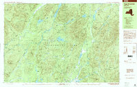
1997 Map of Page Mountain
USGS Topo · Published 2000About this map
Speculator sits at the southern edge of this wilderness survey, marking the primary point of settlement where the Sacandaga River flows toward Sacandaga Lake. The landscape is defined by the convergence of several major water systems, including the Miami River and the Kunjamuk River, which meander through a network of clearings and timbered slopes. Notable clearings like Indian Clearing, Perkins Clearing, and Perrys Clearing suggest a history of seasonal human activity or logging operations within the Adirondack Park boundaries. The terrain is marked by distinctive peaks such as Page Mountain, Oak Mtn, and Dug Mountain, while more secluded landmarks like Kunjamuk Cave and the waters of Christine Falls and Austin Falls indicate a region shaped by significant river descent and natural geologic features. This late-twentieth-century study documents the remote nature of the Lake Pleasant and Wells townships during a period of established conservation.
Find a feature on this map
87 named features on this map. Tap any name to fly to it.
Don’t see what you’re looking for? This feature index may not catch every label — zoom into the map to look around manually.
Map Details
Editions of this 1997 Page Mountain Map
This is the sole edition of this map. No revisions or reprints were ever made.
Other maps of this area

1898 · Thirteenth Lake
USGS Topo · 1:62,500

1899 · Indian Lake
USGS Topo · 1:62,500

1900 · Canada Lake
USGS Topo · 1:62,500

1902 · Indian Lake
USGS Topo · 1:62,500

1903 · West Canada Lakes
USGS Topo · 1:62,500

1904 · Piseco Lake
USGS Topo · 1:62,500

1906 · Piseco Lake
USGS Topo · 1:62,500

1907 · Lake Pleasant
USGS Topo · 1:62,500

1908 · Piseco Lake
USGS Topo · 1:62,500

1910 · Stony Creek
USGS Topo · 1:62,500