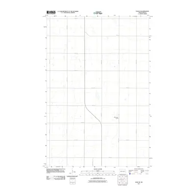
2011 Map of Page SE
USGS Topo · Published 2011About this map
Wilcox Farm Airstrip sits near the center of this rural landscape in Cass County, illustrating the intersection of modern agriculture and private aviation in the Red River Valley. The terrain is defined by a rigid section-line grid of gravel and paved roads, including north-south corridors like 137th Ave SE and 140th Ave SE that facilitate the transport of crops across these expansive flats. This survey provides a clear view of the land division and water management patterns common in eastern North Dakota. The drainage network, characterized by intermittent streams and small sloughs, weaves between arterial routes such as 25th St SE and 138 1/2 Ave SE, showing how the natural hydrology has been adapted for large-scale farming.
Find a feature on this map
18 named features on this map. Tap any name to fly to it.
Don’t see what you’re looking for? This feature index may not catch every label — zoom into the map to look around manually.
Map Details
Editions of this 2011 Page SE Map
This is the sole edition of this map. No revisions or reprints were ever made.
Other maps of this area

1895 · Casselton
USGS Topo · 1:125,000

1897 · Tower
USGS Topo · 1:125,000

1897 · Casselton
USGS Topo · 1:125,000

1952 · Grand Forks
USGS Topo · 1:250,000

1953 · Fargo
USGS Topo · 1:250,000

1956 · Fargo
USGS Topo · 1:250,000

1956 · Grand Forks
USGS Topo · 1:250,000

1966 · Grand Forks
USGS Topo · 1:250,000

1967 · Tower City
USGS Topo · 1:24,000

1967 · Page SE
USGS Topo · 1:24,000