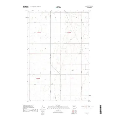
2020 Map of Page SE
USGS Topo · Published 2020About this map
Wilcox Farm Airport stands as the primary namesake landmark in this corner of Cornell Township, appearing as a focal point in a vast landscape of agricultural grids. The area is defined by the rigid geometry of the Public Land Survey System, where townships such as t141n r54w and t142n r55w divide the prairie into orderly sections. This 2020 layout preserves the traditional section lines typical of the Red River Valley, with gravel roads like 24th ST Se and 139th Ave Se tracing the borders of expansive farm fields. Scattered wetlands and depressions break the prairie level, providing a glimpse into the original drainage patterns of the region that persist alongside modern mechanized farming operations.
Find a feature on this map
20 named features on this map. Tap any name to fly to it.
Don’t see what you’re looking for? This feature index may not catch every label — zoom into the map to look around manually.
Map Details
Editions of this 2020 Page SE Map
This is the sole edition of this map. No revisions or reprints were ever made.
Other maps of this area

1895 · Casselton
USGS Topo · 1:125,000

1897 · Tower
USGS Topo · 1:125,000

1897 · Casselton
USGS Topo · 1:125,000

1952 · Grand Forks
USGS Topo · 1:250,000

1953 · Fargo
USGS Topo · 1:250,000

1956 · Fargo
USGS Topo · 1:250,000

1956 · Grand Forks
USGS Topo · 1:250,000

1966 · Grand Forks
USGS Topo · 1:250,000

1967 · Tower City
USGS Topo · 1:24,000

1967 · Page SE
USGS Topo · 1:24,000