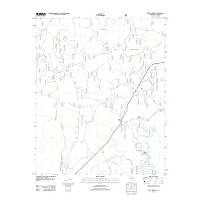
2011 Map of Page Springs
USGS Topo · Published 2011About this map
Oak Creek flows through the southeastern portion of this landscape, supporting the settlement at Page Springs and the nearby Hidden Valley. This 2011 survey reveals an arid environment defined by a sophisticated network of livestock and water management features, evidenced by numerous tanks such as Wheatfield Tank Number One, Jackass Tank, and Spider Tank. The topography is shaped by dramatic landmarks like Windmill Mountain and Anderson Butte, with Loy Canyon cutting through the northern reaches of the terrain.
Find a feature on this map
48 named features on this map. Tap any name to fly to it.
Don’t see what you’re looking for? This feature index may not catch every label — zoom into the map to look around manually.
Map Details
Editions of this 2011 Page Springs Map
This is the sole edition of this map. No revisions or reprints were ever made.
Other maps of this area

1887 · Verde
USGS Topo · 1:250,000

1887 · Prescott
USGS Topo · 1:250,000

1892 · Verde
USGS Topo · 1:250,000

1892 · Prescott
USGS Topo · 1:250,000

1905 · Jerome
USGS Topo · 1:125,000

1923 · Camp Verde
USGS Topo · 1:125,000

1932 · Camp Verde
USGS Topo · 1:125,000

1936 · Camp Verde
USGS Topo · 1:125,000

1944 · Clarkdale
USGS Topo · 1:48,000

1944 · Mingus Mountain
USGS Topo · 1:62,500