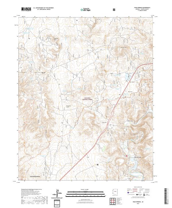
2021 Map of Page Springs
USGS Topo · Published 2021About this map
Page Springs lies along the riparian corridor of Oak Creek in this 2021 topographic study of the central Arizona desert and canyonlands. The landscape is defined by its complex water management system, documented through numerous livestock and irrigation features such as Spring Ditch, White Flat Tank, and Mesa Blanco Tank. This network suggests a history of ranching and early agriculture supported by the unique hydrology of the area, even as modern residential developments appear near the community of Cottonwood. Within the Coconino National Forest, the terrain transitions from the low-lying Negro Flat to prominent elevations like Windmill Mtn and Anderson Butte. A network of historical routes, including Lime Kiln Trl and Bones Trl, cuts across the rugged topography, while the deep recesses of Loy Canyon and Sheepshead Canyon reveal the natural drainage patterns that have shaped this portion of Yavapai County.
Find a feature on this map
49 named features on this map. Tap any name to fly to it.
Don’t see what you’re looking for? This feature index may not catch every label — zoom into the map to look around manually.
Map Details
Editions of this 2021 Page Springs Map
This is the sole edition of this map. No revisions or reprints were ever made.
Other maps of this area

1887 · Verde
USGS Topo · 1:250,000

1887 · Prescott
USGS Topo · 1:250,000

1892 · Verde
USGS Topo · 1:250,000

1892 · Prescott
USGS Topo · 1:250,000

1905 · Jerome
USGS Topo · 1:125,000

1923 · Camp Verde
USGS Topo · 1:125,000

1932 · Camp Verde
USGS Topo · 1:125,000

1936 · Camp Verde
USGS Topo · 1:125,000

1944 · Clarkdale
USGS Topo · 1:48,000

1944 · Mingus Mountain
USGS Topo · 1:62,500