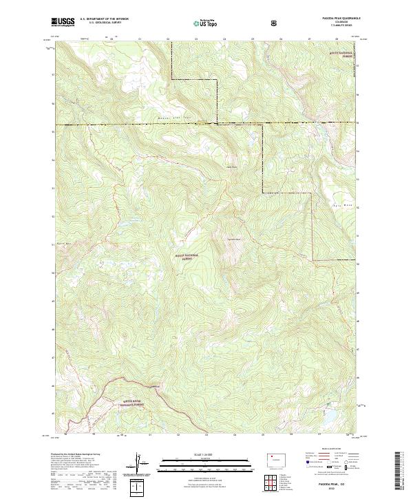
2022 Map of Pagoda Peak
USGS Topo · Published 2022About this map
The Routt National Forest and White River National Forest converge at the high elevations of the Flat Tops in this 2022 survey. The landscape is defined by the prominent Pagoda Peak, which serves as a central landmark for a network of forest trails including the Slide Creek Trl and Pagoda Lake Trl. Significant water features such as Stinsby Reservoir and Pagoda Lake suggest the critical role of high-altitude water management in this part of Colorado. High plateaus and ridgelines like Beaver Flat Tops and Egry Mesa frame the drainages of Pagoda Cr and the North Williams Fork. The map also details remote back-country sites like Cyclone Park, accessible via the Cyclone Park Trl, providing a clear view of the modern trail and forest road system across Rio Blanco Co and Routt Co.
Find a feature on this map
32 named features on this map. Tap any name to fly to it.
Don’t see what you’re looking for? This feature index may not catch every label — zoom into the map to look around manually.
Map Details
Editions of this 2022 Pagoda Peak Map
This is the sole edition of this map. No revisions or reprints were ever made.
Other maps of this area

1916 · Daton Peak
USGS Topo · 1:62,500

1920 · Daton Peak
USGS Topo · 1:62,500

1924 · Mt. Harris
USGS Topo · 1:48,000

1926 · Mount Harris
USGS Topo · 1:62,500

1954 · Craig
USGS Topo · 1:250,000

1957 · Craig
USGS Topo · 1:250,000

1958 · Craig
USGS Topo · 1:250,000

1960 · Craig
USGS Topo · 1:250,000

1962 · Craig
USGS Topo · 1:250,000

1964 · Craig
USGS Topo · 1:250,000