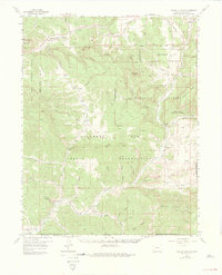
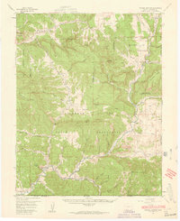
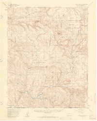
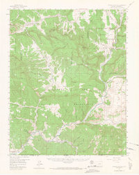
1957 Map of Pagosa Junction
USGS Topo · Published 1975About this map
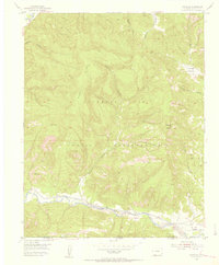
The Denver and Rio Grande Western Railroad tracks follow the winding course of the San Juan River through this southern Colorado landscape, anchoring a series of small settlements and sidings during the mid-20th century. At Pagosa Junction (Gato), the rail line meets the San Juan, serving as a vital transportation hub for the surrounding Southern Ute Indian Reservation. The geography is defined by deep incisions like Stinking Springs Canyon and Kearns Canyon, which give way to broad features such as Eightmile Mesa and Archuleta Mesa.
Find a feature on this map
57 named features on this map. Tap any name to fly to it.
Don’t see what you’re looking for? This feature index may not catch every label — zoom into the map to look around manually.
Map Details
Editions of this 1957 Pagosa Junction Map
4 editions found
Other maps of this area

1889 · Largo
USGS Topo · 1:250,000

1895 · Largo
USGS Topo · 1:250,000

1913 · Summitville
USGS Topo · 1:125,000

1915 · Summitville
USGS Topo · 1:125,000

1924 · Pagosa Springs
USGS Topo · 1:125,000

1927 · Pagosa Springs
USGS Topo · 1:125,000

1945 · Durango
USGS Topo · 1:250,000

1953 · Durango
USGS Topo · 1:250,000

1954 · Durango
USGS Topo · 1:250,000
1954 · Carracas
USGS Topo · 1:24,000