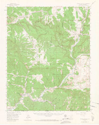
1957 Map of Pagosa Junction
USGS Topo · Published 1965About this map
The San Juan River and the Denver and Rio Grande Western Railroad define the southern corridor of this rugged territory on the Colorado-New Mexico border. Most of the landscape is dominated by the Southern Ute Indian Reservation and the San Juan National Forest, where deep drainages like Gomez Canyon and Stinking Springs Canyon carve through high plateaus. Small settlements and points of interest such as Pagosa Junction, Juanita, and Trujillo are concentrated along the river valley, marking the primary human footprint in a terrain of mesas and gap crossings. This mid-century survey captures the region's complex land management boundaries, including the South Boundary Ute Ceded Land, while tracing the paths of the historical Navajo Trail and several remote Jeep Trails.
Find a feature on this map
61 named features on this map. Tap any name to fly to it.
Don’t see what you’re looking for? This feature index may not catch every label — zoom into the map to look around manually.
Map Details
Editions of this 1957 Pagosa Junction Map
4 editions found

Other maps of this area

1889 · Largo
USGS Topo · 1:250,000

1895 · Largo
USGS Topo · 1:250,000

1913 · Summitville
USGS Topo · 1:125,000

1915 · Summitville
USGS Topo · 1:125,000

1924 · Pagosa Springs
USGS Topo · 1:125,000

1927 · Pagosa Springs
USGS Topo · 1:125,000

1945 · Durango
USGS Topo · 1:250,000

1953 · Durango
USGS Topo · 1:250,000

1954 · Durango
USGS Topo · 1:250,000

1954 · Carracas
USGS Topo · 1:24,000