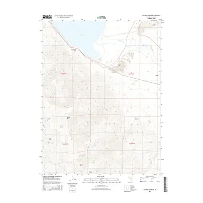
2014 Map of Pah Rah Mountain
USGS Topo · Published 2014About this map
Pyramid Lake dominates the northern horizon of this 2014 survey, where the Truckee River flows toward the terminal basin near the settlement of Nixon. The terrain is defined by the high elevations of the Pah Rah Range, anchored by Virginia Peak and Pah Rah Mtn. This arid landscape is deeply etched by drainage systems like Big Mouth Canyon and Piute Cañon, which funnel seasonal runoff toward the desert floor. Water sources are critical landmarks here, with named points such as Rosebush Spring, Twin Springs, and Mud Spring providing vital nodes in the high-desert ecology. Along the eastern edge, Marble Bluff overlooks the river valley, marking a distinct geological transition near the lake shore. The map illustrates the sparsely populated character of Washoe County, where few roads like Rodero Rd penetrate the interior of these mountains.
Find a feature on this map
26 named features on this map. Tap any name to fly to it.
Don’t see what you’re looking for? This feature index may not catch every label — zoom into the map to look around manually.
Map Details
Editions of this 2014 Pah Rah Mountain Map
This is the sole edition of this map. No revisions or reprints were ever made.
Other maps of this area

1890 · Wadsworth
USGS Topo · 1:125,000

1891 · Reno
USGS Topo · 1:125,000

1892 · Wadsworth
USGS Topo · 1:125,000

1893 · Reno
USGS Topo · 1:125,000

1894 · Wadsworth
USGS Topo · 1:125,000

1957 · Sutcliffe
USGS Topo · 1:62,500

1957 · Spanish Springs Valley
USGS Topo · 1:62,500

1957 · Wadsworth
USGS Topo · 1:62,500

1957 · Nixon
USGS Topo · 1:62,500

1957 · Reno
USGS Topo · 1:250,000