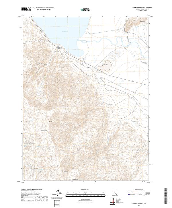
2021 Map of Pah Rah Mountain
USGS Topo · Published 2021About this map
The southern tip of Pyramid Lake and its significant Truckee River Outlet anchor this 2021 study of the Washoe County high desert. The landscape is defined by the steep elevation gains of the Pah Rah Range, culminating at Pah Rah Mtn and the prominent Virginia Peak. The hydrology of this arid environment is precisely mapped, showing vital water sources such as Rosebush Spring, Twin Springs, and Mud Spring which have historically supported life in the canyons.
Find a feature on this map
29 named features on this map. Tap any name to fly to it.
Don’t see what you’re looking for? This feature index may not catch every label — zoom into the map to look around manually.
Map Details
Editions of this 2021 Pah Rah Mountain Map
This is the sole edition of this map. No revisions or reprints were ever made.
Other maps of this area

1890 · Wadsworth
USGS Topo · 1:125,000

1891 · Reno
USGS Topo · 1:125,000

1892 · Wadsworth
USGS Topo · 1:125,000

1893 · Reno
USGS Topo · 1:125,000

1894 · Wadsworth
USGS Topo · 1:125,000

1957 · Sutcliffe
USGS Topo · 1:62,500

1957 · Spanish Springs Valley
USGS Topo · 1:62,500

1957 · Wadsworth
USGS Topo · 1:62,500

1957 · Nixon
USGS Topo · 1:62,500

1957 · Reno
USGS Topo · 1:250,000