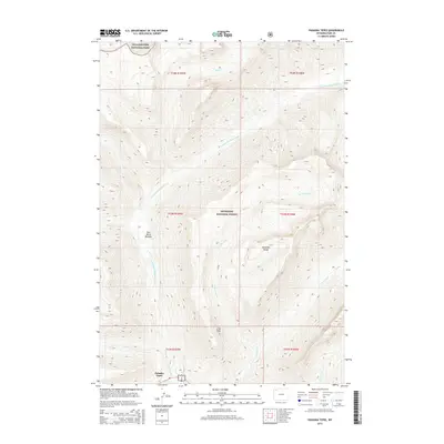
2015 Map of Pahaska Tepee
USGS Topo · Published 2015About this map
Pahaska Tepee serves as the focal point for this high-altitude landscape where the eastern boundary of Yellowstone National Park meets the Shoshone National Forest. The geography is defined by the sharp elevations of the Absaroka Range, with the North Fork Shoshone River carving a primary corridor through the mountain terrain. Numerous tributaries, including Red Cr, Grinnell Cr, and Mormon Cr, drain the steep slopes and narrow valleys of this wilderness area.
Find a feature on this map
21 named features on this map. Tap any name to fly to it.
Don’t see what you’re looking for? This feature index may not catch every label — zoom into the map to look around manually.
Map Details
Editions of this 2015 Pahaska Tepee Map
This is the sole edition of this map. No revisions or reprints were ever made.
Other maps of this area

1885 · Lake
USGS Topo · 1:125,000

1886 · Canyon
USGS Topo · 1:125,000

1893 · Ishawooa
USGS Topo · 1:125,000

1895 · Ishawooa
USGS Topo · 1:125,000

1895 · Canyon
USGS Topo · 1:125,000

1895 · Lake
USGS Topo · 1:125,000

1896 · Lake
USGS Topo · 1:125,000

1896 · Canyon
USGS Topo · 1:125,000

1896 · Crandall Creek
USGS Topo · 1:125,000

1899 · Crandall
USGS Topo · 1:125,000