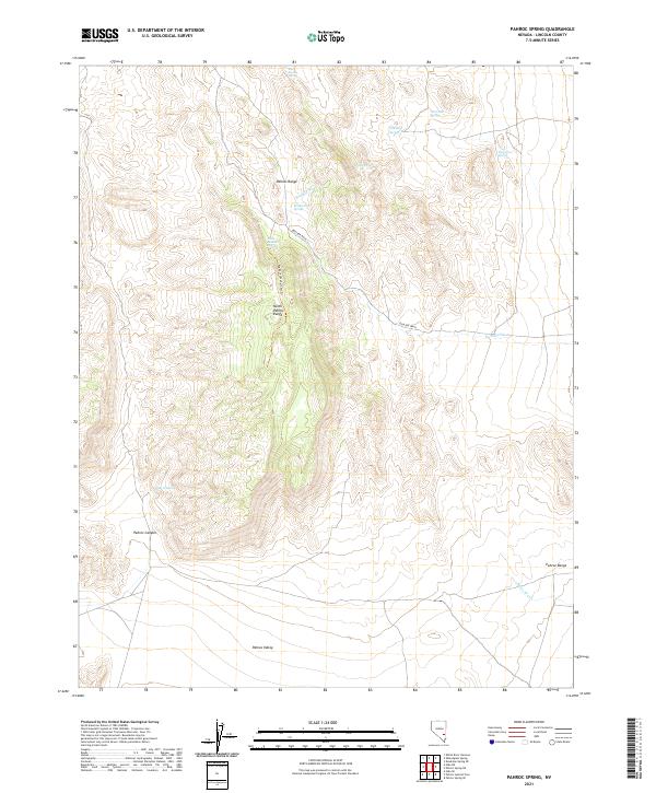
2021 Map of Pahroc Spring
USGS Topo · Published 2021About this map
The Pahroc Range and the North Pahroc Range dominate this desert landscape in Lincoln County, Nevada. The high terrain is defined by a series of springs that have historically provided essential water sources in an otherwise arid environment. These points include Pahroc Spring, Brinkerhoff Spring, and Red Rock Spring, which sit at various elevations among the rocky outcrops. The presence of the Big Rocks Wilderness Trl suggests the area's value for preservation and recreation, leading through the heart of the mountain range.
Find a feature on this map
22 named features on this map. Tap any name to fly to it.
Don’t see what you’re looking for? This feature index may not catch every label — zoom into the map to look around manually.
Map Details
Editions of this 2021 Pahroc Spring Map
This is the sole edition of this map. No revisions or reprints were ever made.
Other maps of this area

1885 · Pioche
USGS Topo · 1:250,000

1886 · Pioche
USGS Topo · 1:250,000

1954 · Caliente
USGS Topo · 1:250,000

1959 · Caliente
USGS Topo · 1:250,000

1970 · Hiko NE
USGS Topo · 1:24,000
1970 · Pahroc Summit Pass
USGS Topo · 1:24,000

1970 · Hiko SE
USGS Topo · 1:24,000
1970 · Deadman Spring SE
USGS Topo · 1:24,000
1970 · Pahroc Spring SE
USGS Topo · 1:24,000

1970 · Wheatgrass Spring
USGS Topo · 1:24,000