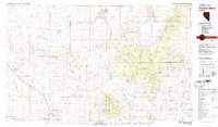
1979 Map of Pahute Mesa
USGS Topo · Published 1980About this map
Nellis Air Force Range and the Nevada Test Site dominate this 1970s landscape, illustrating the heavy footprint of the Cold War and atomic research in the Nevada desert. The map reveals the intricate network of the Pahute Mesa and Timber Mountain regions, where the land was repurposed for military and scientific use. Along with tactical infrastructure like a tracking station and various landing strips, the map documents early industrial remnants such as the Clarkdale Mine and Yellow Gold Mine near the Tolicha Peak.
Find a feature on this map
77 named features on this map. Tap any name to fly to it.
Don’t see what you’re looking for? This feature index may not catch every label — zoom into the map to look around manually.
Map Details
Editions of this 1979 Pahute Mesa Map
2 editions found
Other maps of this area

1907 · Las Vegas
USGS Topo · 1:250,000

1908 · Kawich
USGS Topo · 1:250,000

1908 · Lida
USGS Topo · 1:250,000

1908 · Furnace Creek
USGS Topo · 1:250,000

1908 · Las Vegas
USGS Topo · 1:250,000

1908 · Ballarat
USGS Topo · 1:250,000

1910 · Furnace Creek
USGS Topo · 1:250,000

1913 · Lida
USGS Topo · 1:250,000

1913 · Ballarat
USGS Topo · 1:250,000

1942 · Emigrant Valley
USGS Topo · 1:125,000