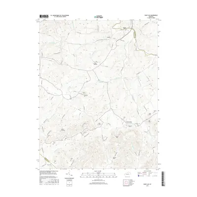
2016 Map of Paint Lick
USGS Topo · Published 2016About this map
Paint Lick and Cartersville anchor this 2016 survey along the border of Garrard, Madison, and Lincoln counties. The landscape is defined by the winding course of Paint Lick Creek and its many tributaries, such as White Lick Creek and Full Lick. Evidence of the region’s early transportation network remains visible through the Old Railroad Grade Rd near Lowell and Manse. For those researching local family history, several burial sites are documented, including Stringtown Cem, Collett Cem, and Ramsey Cem. The terrain rises into distinctive heights such as Button Lick Knob and Steve Knob, while the Cartersville Airport provides a modern navigational landmark in the southeastern portion of the quadrangle.
Find a feature on this map
89 named features on this map. Tap any name to fly to it.
Don’t see what you’re looking for? This feature index may not catch every label — zoom into the map to look around manually.
Map Details
Editions of this 2016 Paint Lick Map
This is the sole edition of this map. No revisions or reprints were ever made.
Other maps of this area

1892 · Richmond
USGS Topo · 1:125,000

1893 · London
USGS Topo · 1:125,000

1897 · Richmond
USGS Topo · 1:125,000

1897 · London
USGS Topo · 1:125,000

1905 · Harrodsburg
USGS Topo · 1:125,000

1952 · Berea
USGS Topo · 1:24,000

1952 · Crab Orchard
USGS Topo · 1:24,000

1952 · Buckeye
USGS Topo · 1:24,000

1952 · Paint Lick
USGS Topo · 1:24,000

1952 · Lancaster
USGS Topo · 1:24,000