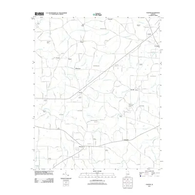
2011 Map of Painter
USGS Topo · Published 2011About this map
Sand Mountain dominates the center of this rural landscape, which is marked by a dense network of creek branches and numerous historic river crossings. Several small community hubs are scattered across the plateau, including Painter, Whiton, and Kilpatrick, linked by a web of county roads that follow the drainage patterns of Whippoorwill Creek and Scarham Creek. The density of bridges and fords, such as Garvin Bridge, Luther Bridge, and Clayton Ford, speaks to the importance of maintaining local transport routes across the winding waterways that bisect the farmland.
Find a feature on this map
179 named features on this map. Tap any name to fly to it.
Don’t see what you’re looking for? This feature index may not catch every label — zoom into the map to look around manually.
Map Details
Editions of this 2011 Painter Map
This is the sole edition of this map. No revisions or reprints were ever made.
Other maps of this area

1885 · Gadsden
USGS Topo · 1:125,000

1888 · Gadsden
USGS Topo · 1:125,000

1892 · Gadsden
USGS Topo · 1:125,000

1893 · Fort Payne
USGS Topo · 1:125,000

1895 · Gadsden
USGS Topo · 1:125,000

1898 · Fort Payne
USGS Topo · 1:125,000

1900 · Fort Payne
USGS Topo · 1:125,000

1903 · Gadsden
USGS Topo · 1:125,000

1936 · Painter
USGS Topo · 1:24,000

1936 · Crossville
USGS Topo · 1:24,000