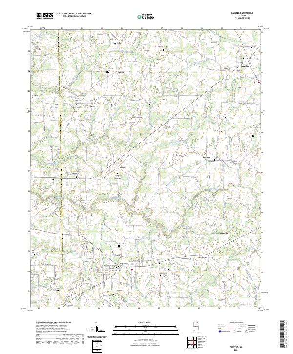
2024 Map of Painter
USGS Topo · Published 2024About this map
Sand Mountain dominates the landscape of this DeKalb County survey, where a high concentration of cemeteries and small communities reflects a long-settled agrarian history. Central to this map is Painter, characterized by the Painter Liberty Baptist Cem and Freeman Chapel Cem, while the town of Geraldine occupies the northeastern corner. The area is defined by a dense network of country roads and numerous waterways, including Whippoorwill Creek and Scarham Creek, which carve through the plateau.
Find a feature on this map
189 named features on this map. Tap any name to fly to it.
Don’t see what you’re looking for? This feature index may not catch every label — zoom into the map to look around manually.
Map Details
Editions of this 2024 Painter Map
This is the sole edition of this map. No revisions or reprints were ever made.
Other maps of this area

1885 · Gadsden
USGS Topo · 1:125,000

1888 · Gadsden
USGS Topo · 1:125,000

1892 · Gadsden
USGS Topo · 1:125,000

1893 · Fort Payne
USGS Topo · 1:125,000

1895 · Gadsden
USGS Topo · 1:125,000

1898 · Fort Payne
USGS Topo · 1:125,000

1900 · Fort Payne
USGS Topo · 1:125,000

1903 · Gadsden
USGS Topo · 1:125,000

1936 · Painter
USGS Topo · 1:24,000

1936 · Crossville
USGS Topo · 1:24,000