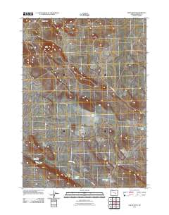
2011 Map of Paiute Butte
USGS Topo · Published 2011About this map
Paiute Butte and the surrounding high desert of Harney County are defined by a network of ephemeral basins and volcanic landforms. The landscape is marked by numerous dry or seasonal water bodies, including China Lake, Papoose Lake, and Yellowstone Lake. These features, along with Blowhole Lake and Evening Lake, suggest a complex hydrological system where water collects in shallow depressions across the plateau.
Find a feature on this map
11 named features on this map. Tap any name to fly to it.
Don’t see what you’re looking for? This feature index may not catch every label — zoom into the map to look around manually.
Map Details
Editions of this 2011 Paiute Butte Map
This is the sole edition of this map. No revisions or reprints were ever made.
Other maps of this area

1955 · Burns
USGS Topo · 1:250,000

1958 · Burns
USGS Topo · 1:250,000

1959 · Burns
USGS Topo · 1:250,000

1980 · Capehart Lake
USGS Topo · 1:24,000

1980 · Squaw Butte
USGS Topo · 1:24,000

1980 · Alec Butte
USGS Topo · 1:24,000

1980 · Hay Lake
USGS Topo · 1:24,000

1980 · Wagontire Mtn East
USGS Topo · 1:24,000

1980 · Lake on The Trail
USGS Topo · 1:24,000
1981 · Potato Hills
USGS Topo · 1:24,000