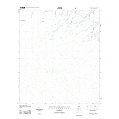
2012 Map of Pajarito Peak
USGS Topo · Published 2012About this map
Pajarito Peak stands as the central landmark of this high-desert terrain, anchoring a landscape defined by the drainage systems of the Pajarito Mountains. The network of intermittent water sources is the defining characteristic of this area along the Arizona-Sonora border, where a complex system of cattle tanks and natural springs supported ranching operations. Significant water features such as Bull Spring, Adobe Spring, and Russell Spring appear alongside numerous man-made catchments like Little Alamo Tank and Monument Tank. The map also traces the drainage of Potrero Cr and the prominent elevation of Mojohave Ridge. The inclusion of Mine Shaft Spring suggests a history of small-scale mineral exploration common to this remote borderland region, while the density of named tanks illustrates the critical importance of water management in the arid environment.
Find a feature on this map
22 named features on this map. Tap any name to fly to it.
Don’t see what you’re looking for? This feature index may not catch every label — zoom into the map to look around manually.
Map Details
Editions of this 2012 Pajarito Peak Map
This is the sole edition of this map. No revisions or reprints were ever made.
Other maps of this area

1905 · Nogales
USGS Topo · 1:125,000

1921 · Old Glory
USGS Topo · 1:125,000

1933 · Calabasas
USGS Topo · 1:62,500

1942 · Ruby
USGS Topo · 1:62,500

1943 · Old Glory
USGS Topo · 1:125,000

1956 · Nogales
USGS Topo · 1:250,000
1957 · Ruby
USGS Topo · 1:62,500

1958 · Nogales
USGS Topo · 1:250,000
1958 · Nogales
USGS Topo · 1:62,500

1959 · Nogales
USGS Topo · 1:250,000