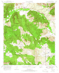
1949 Map of Pala
USGS Topo · Published 1966About this map
The Pala Indian Reservation dominates the northern landscape of this San Diego County region, centered on the historic settlement of Pala. The community is anchored by a local Mission and the Pala Cem, situated along the winding course of the San Luis Rey River. Industry and land use are evidenced by the presence of a Pumping Sta and specialized mining operations such as the Katerina Mine and Fargo Mine near Heriot Mtn. To the south, the terrain transitions into agricultural and ranching lands, including Rancho Lilac and the small settlement of Lilac. Transport is facilitated by the Mission Road and Grade Road, which connect the river valley to the rising peaks of Pala Mountain. This survey captures a moment when the Pauma Valley maintained a distinctly rural character, featuring a private Airfield (Private) and several scattered windmills.
Find a feature on this map
37 named features on this map. Tap any name to fly to it.
Don’t see what you’re looking for? This feature index may not catch every label — zoom into the map to look around manually.
Map Details
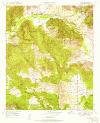
Editions of this 1949 Pala Map
2 editions found
Other maps of this area

1893 · Escondido
USGS Topo · 1:62,500

1901 · Escondido
USGS Topo · 1:62,500

1901 · San Luis Rey
USGS Topo · 1:125,000

1903 · Ramona
USGS Topo · 1:125,000

1904 · Southern California Sheet No. 2
USGS Topo · 1:250,000

1939 · Palomar Mountain
USGS Topo · 1:62,500

1942 · Temecula
USGS Topo · 1:62,500

1942 · Escondido
USGS Topo · 1:62,500

1942 · Ramona
USGS Topo · 1:62,500

1947 · Ramona
USGS Topo · 1:62,500