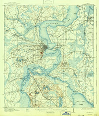
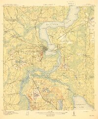
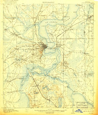
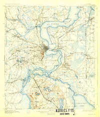
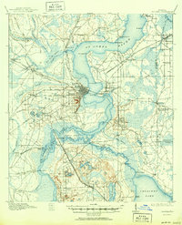
1915 Map of Palatka
USGS Topo · Published 1942About this map
St Johns River serves as the central artery for this Putnam County landscape, where the wide waters narrow through the Devils Elbow and sweep past Palatka. The map illustrates a complex riverine environment punctuated by numerous named landings such as Horse Landing and Pomona Landing, which were vital for transport before the expansion of roads. Inland, the arrival of the Atlantic Coast Line and the Florida East Coast railroads transformed the economy, supporting established agricultural centers like Hastings and San Mateo.
Find a feature on this map
93 named features on this map. Tap any name to fly to it.
Don’t see what you’re looking for? This feature index may not catch every label — zoom into the map to look around manually.
Map Details
Editions of this 1915 Palatka Map
6 editions found
Other maps of this area

1912 · Palatka
USGS Topo · 1:48,000

1915 · Palatka
USGS Topo · 1:62,500

1915 · Interlachen
USGS Topo · 1:48,000

1916 · Interlachen
USGS Topo · 1:62,500

1937 · Elkton
USGS Topo · 1:24,000

1937 · Dinner Island
USGS Topo · 1:48,000

1942 · Ates Creek
USGS Topo · 1:62,500
1943 · St. Augustine
USGS Topo · 1:62,500

1943 · Dinner Island
USGS Topo · 1:62,500

1944 · Dinner Island
USGS Topo · 1:62,500