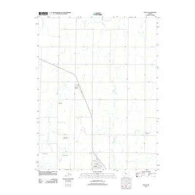
2012 Map of Palco
USGS Topo · Published 2012About this map
Damar and Palco anchor this Rooks County landscape, where the agricultural grid of Western Kansas meets a significant energy corridor. The map reveals the local economy's dual reliance on the land, with organized farming plots intersected by the Gra-Rook Oil Field, Gra-Rook North Oil Field, and Morel Oil Field. These petroleum-producing zones are situated among the drainage basins of the S Fork Solomon River and Spring Cr, showing the spatial relationship between industrial extraction and the natural watershed.
Find a feature on this map
33 named features on this map. Tap any name to fly to it.
Don’t see what you’re looking for? This feature index may not catch every label — zoom into the map to look around manually.
Map Details
Editions of this 2012 Palco Map
This is the sole edition of this map. No revisions or reprints were ever made.
Other maps of this area

1893 · Hill
USGS Topo · 1:125,000

1896 · Plainville
USGS Topo · 1:125,000

1952 · Webster Dam
USGS Topo · 1:24,000

1955 · Beloit
USGS Topo · 1:250,000

1959 · Beloit
USGS Topo · 1:250,000

1969 · Nicodemus
USGS Topo · 1:24,000

1969 · Palco
USGS Topo · 1:24,000

1969 · Stockton SW
USGS Topo · 1:24,000
1978 · Zurich
USGS Topo · 1:24,000

1979 · Bogue
USGS Topo · 1:24,000