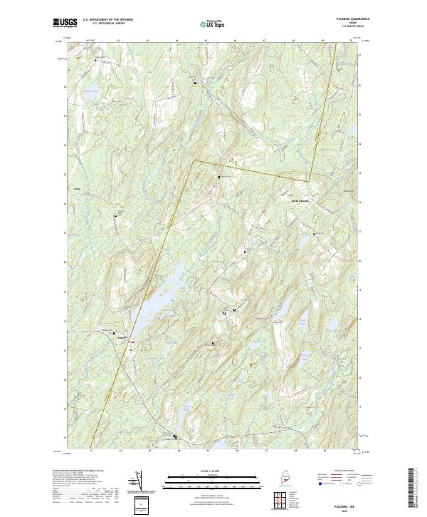
2024 Map of Palermo
USGS Topo · Published 2024About this map
Palermo and North Palermo anchor a landscape defined by its high density of family and community burial grounds, reflecting the deep genealogical roots of this Waldo County region. The terrain is marked by a complex network of ponds and watercourses, including the West Branch Sheepscot River and the large Hackmatack Pond. This survey details several specific cemeteries such as Old Greeley Corner Cem, New Greeley Corner Cem, and Branch Mills Cem, which are essential for those researching local lineage. The road network, including the boundary between Kennebec and Waldo counties, weaves through hills like Libby Hill and Sanford Hill, connecting small settlements like Coles with the more established village centers and the numerous small ponds such as Bear Pond and Dowe Pond.
Find a feature on this map
98 named features on this map. Tap any name to fly to it.
Don’t see what you’re looking for? This feature index may not catch every label — zoom into the map to look around manually.
Map Details
Editions of this 2024 Palermo Map
This is the sole edition of this map. No revisions or reprints were ever made.
Other maps of this area

1892 · Waterville
USGS Topo · 1:62,500

1893 · Vassalboro
USGS Topo · 1:62,500

1898 · Vassalboro
USGS Topo · 1:62,500

1916 · Liberty
USGS Topo · 1:62,500

1926 · Burnham
USGS Topo · 1:62,500

1941 · Vassalboro
USGS Topo · 1:62,500

1942 · Liberty
USGS Topo · 1:62,500

1943 · Vassalboro
USGS Topo · 1:62,500

1943 · Waterville
USGS Topo · 1:62,500

1948 · Bangor
USGS Topo · 1:250,000