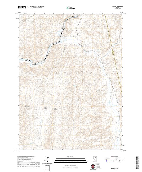
2021 Map of Palisade
USGS Topo · Published 2021About this map
The Humboldt River winds through the northern reach of this Nevada landscape, cutting a deep path through Palisade Canyon before reaching the settlement of Palisade. This region serves as a crucial corridor for both water and transportation, where the Palisade Ranch Rd and Frenchie Rd connect the high desert valley to the surrounding peaks. The terrain is defined by the steep rises of the Cortez Mountains and Iron Blossom Mtn, creating a dramatic backdrop for the smaller settlement at Pine Valley. Water is the lifeblood of this arid environment, marked by essential points like Raine Ranch Springs, Emigrant Spring, and Rock Spring, which have historically supported ranching and transit through the high basins. The map illustrates a network of seasonal drainages including Ferdelford Cr and Thomas Cr that feed into the larger river system during the spring runoff.
Find a feature on this map
25 named features on this map. Tap any name to fly to it.
Don’t see what you’re looking for? This feature index may not catch every label — zoom into the map to look around manually.
Map Details
Editions of this 2021 Palisade Map
This is the sole edition of this map. No revisions or reprints were ever made.
Other maps of this area

1952 · Pine Valley
USGS Topo · 1:62,500

1952 · Carlin
USGS Topo · 1:62,500

1955 · Winnemucca
USGS Topo · 1:250,000

1957 · Frenchie Creek
USGS Topo · 1:62,500

1957 · Beowawe
USGS Topo · 1:62,500

1958 · Winnemucca
USGS Topo · 1:250,000

1962 · Winnemucca
USGS Topo · 1:250,000
1975 · Carlin NE
USGS Topo · 1:24,000

1985 · Scotts Gulch
USGS Topo · 1:24,000
1985 · Ravens Nest
USGS Topo · 1:24,000