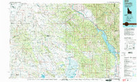
1986 Map of Palisades
USGS Topo · Published 1987About this map
The Caribou Range dominates this mid-1980s landscape, serving as a divider between the high-altitude basins and the powerful Snake River valley. The map reveals a region defined by federal land management and massive water projects, from the Caribou National Forest to the expansive Palisades Reservoir. To the west, the urban edge of Idaho Falls and Ammon gives way to the irrigation-heavy drainage of Willow Creek, while the Union Pacific RR follows the northern corridor.
Find a feature on this map
66 named features on this map. Tap any name to fly to it.
Don’t see what you’re looking for? This feature index may not catch every label — zoom into the map to look around manually.
Map Details
Editions of this 1986 Palisades Map
2 editions found
Other maps of this area

1899 · Grand Teton
USGS Topo · 1:125,000

1901 · Grand Teton
USGS Topo · 1:125,000

1914 · Henry
USGS Topo · 1:48,000

1915 · Freedom
USGS Topo · 1:62,500

1915 · Lanes Creek
USGS Topo · 1:62,500

1916 · Henry
USGS Topo · 1:62,500

1917 · Portneuf
USGS Topo · 1:62,500

1917 · Cranes Flat
USGS Topo · 1:62,500

1918 · Paradise Valley
USGS Topo · 1:62,500

1921 · Afton
USGS Topo · 1:125,000