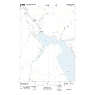
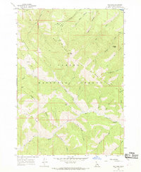
2011 Map of Palisades Dam
USGS Topo · Published 2011About this map
Palisades Dam stands as the central engineering feat of this Idaho landscape, controlling the waters that form the expansive Palisades Reservoir. To the northwest, the settlement of Palisades and the Camp Little Lemhi facility occupy the banks of the Snake River before it enters the impoundment. The terrain is characterized by a series of steep drainages including Sawmill Canyon, Elbow Canyon, and Booth Canyon, which cut through the high country surrounding Sheep Creek Peak. Downstream from the dam, the river corridor is navigated by forest development roads, while the southern reaches of the reservoir reveal historic river crossings such as Edwards Ferry. The geography transitions from the flat expanse of Deer Flat to the dramatic overlooks at Calamity Point and Van Point, illustrating the complex intersection of water management and natural mountain topography.
Find a feature on this map
41 named features on this map. Tap any name to fly to it.
Don’t see what you’re looking for? This feature index may not catch every label — zoom into the map to look around manually.
Map Details
Editions of this 2011 Palisades Dam Map
This is the sole edition of this map. No revisions or reprints were ever made.
Other maps of this area

1932 · Irwin
USGS Topo · 1:96,000

1935 · Irwin
USGS Topo · 1:125,000

1955 · Driggs
USGS Topo · 1:250,000

1958 · Driggs
USGS Topo · 1:250,000

1962 · Driggs
USGS Topo · 1:250,000
1966 · Palisades Peak
USGS Topo · 1:24,000
1966 · Alpine
USGS Topo · 1:24,000

1966 · Big Elk Mtn
USGS Topo · 1:24,000
1966 · Thompson Peak
USGS Topo · 1:24,000
1966 · Red Ridge
USGS Topo · 1:24,000