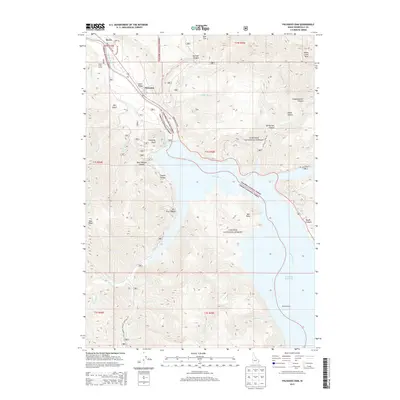
2013 Map of Palisades Dam
USGS Topo · Published 2013About this map
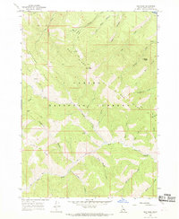
Swan Valley and the Palisades settlement occupy the fertile bend of the Snake River in this 2013 survey, illustrating the managed landscape of Bonneville County. The map is dominated by the northern reaches of the Palisades Reservoir, a vital water resource bordered by the expansive tracts of the Targhee National Forest and Caribou National Forest. Topographical details reveal a complex network of canyons and peaks that hem in the river valley, including Conglomerate Canyon and the prominent Sheep Creek Peak to the northeast. Human impact on the land is marked by the presence of Camp Little Lemhi and historic crossing points like Edwards Ferry. The transition from the developed Swan Valley Hwy corridor to the wilderness areas of Calamity Point and Red Ridge highlights the region's balance between agricultural settlement and protected federal forest lands.
Find a feature on this map
85 named features on this map. Tap any name to fly to it.
Don’t see what you’re looking for? This feature index may not catch every label — zoom into the map to look around manually.
Map Details
Editions of this 2013 Palisades Dam Map
This is the sole edition of this map. No revisions or reprints were ever made.
Other maps of this area

1932 · Irwin
USGS Topo · 1:96,000

1935 · Irwin
USGS Topo · 1:125,000

1955 · Driggs
USGS Topo · 1:250,000

1958 · Driggs
USGS Topo · 1:250,000

1962 · Driggs
USGS Topo · 1:250,000
1966 · Palisades Peak
USGS Topo · 1:24,000
1966 · Alpine
USGS Topo · 1:24,000

1966 · Big Elk Mtn
USGS Topo · 1:24,000
1966 · Thompson Peak
USGS Topo · 1:24,000
1966 · Red Ridge
USGS Topo · 1:24,000