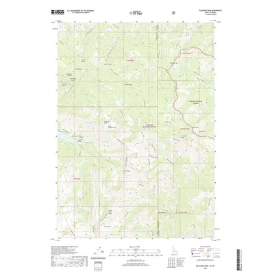
2020 Map of Palisades Peak
USGS Topo · Published 2020About this map
The Snake River Range dominates this corner of the High Rockies, where the border between Idaho and Wyoming cuts through the heart of the Targhee National Forest and Teton National Forest. Rising to prominent heights at Palisades Peak and Starvation Peak, the landscape is a complex of deep drainages such as Ice Cove Canyon and Lorian Canyon. The map reveals a high-altitude network of resource management and historic movement, indicated by the Sheep Driveway and scattered backcountry landmarks like Hunts Corral, Mikesell, and Sheep Camp. Water is the primary sculptor of this terrain, with the N Fork Palisades Creek and Waterfall Creek feeding into the larger system. This 2020 record captures a wilderness shaped by both natural features like Upper Lake and the administrative footprints of the Bonneville and Teton County line.
Find a feature on this map
60 named features on this map. Tap any name to fly to it.
Don’t see what you’re looking for? This feature index may not catch every label — zoom into the map to look around manually.
Map Details
Editions of this 2020 Palisades Peak Map
This is the sole edition of this map. No revisions or reprints were ever made.
Other maps of this area

1899 · Grand Teton
USGS Topo · 1:125,000

1901 · Grand Teton
USGS Topo · 1:125,000

1931 · Jackson
USGS Topo · 1:125,000

1932 · Irwin
USGS Topo · 1:96,000

1935 · Irwin
USGS Topo · 1:125,000

1935 · Jackson
USGS Topo · 1:125,000

1943 · Driggs
USGS Topo · 1:62,500

1946 · Driggs
USGS Topo · 1:62,500

1955 · Driggs
USGS Topo · 1:250,000

1958 · Driggs
USGS Topo · 1:250,000