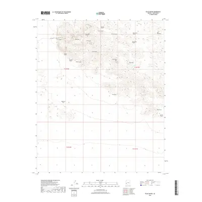
2018 Map of Palm Canyon
USGS Topo · Published 2018About this map
The Kofa Mountains rise sharply in this desert landscape, defined by deep incisions like Palm Canyon and Kofa Queen Canyon. The area is a labyrinth of steep drainage systems and high summits, including Signal Peak and Old Smokey Mtn. In the south, the terrain descends into the broad expanse of King Valley, punctuated by landmarks such as Stagecoach Pass. The presence of the Palm Canyon Trail suggests the historical and recreational importance of this specific drainage, while labels like Tunnel Mine Canyon hint at the prospecting history that once drew people into these arid heights. Geologic features are prominent throughout the quadrangle, notably the Natural Arch and the varied washes like Hoodoo Wash that channel seasonal runoff through the volcanic rock formations.
Find a feature on this map
27 named features on this map. Tap any name to fly to it.
Don’t see what you’re looking for? This feature index may not catch every label — zoom into the map to look around manually.
Map Details
Editions of this 2018 Palm Canyon Map
This is the sole edition of this map. No revisions or reprints were ever made.
Other maps of this area

1942 · Blythe
USGS Topo · 1:250,000

1942 · Vicksburg
USGS Topo · 1:250,000

1954 · Salton Sea
USGS Topo · 1:250,000

1954 · Phoenix
USGS Topo · 1:250,000

1955 · Salton Sea
USGS Topo · 1:250,000

1957 · Phoenix
USGS Topo · 1:250,000

1958 · Phoenix
USGS Topo · 1:250,000

1959 · Salton Sea
USGS Topo · 1:250,000

1960 · Phoenix
USGS Topo · 1:250,000

1962 · Kofa Butte
USGS Topo · 1:62,500