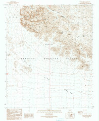
1990 Map of Palm Canyon
USGS Topo · Published 1990About this map
The Kofa Mountains dominate this 1990 provisional survey of Yuma County, illustrating a landscape defined by extreme elevation changes and sparse water sources. The map centers on the Kofa National Wildlife Refuge, where the high summits of Signal Peak and Ten Ewe Mountain overlook a network of deep canyons, including Four Palms Canyon and Hidden Canyon. The presence of Kofa Queen Mine Prospects and various unnamed prospects near Tunnel Mine Canyon indicates a history of mineral exploration in these arid peaks.
Find a feature on this map
31 named features on this map. Tap any name to fly to it.
Don’t see what you’re looking for? This feature index may not catch every label — zoom into the map to look around manually.
Map Details
Editions of this 1990 Palm Canyon Map
This is the sole edition of this map. No revisions or reprints were ever made.
Other maps of this area

1942 · Blythe
USGS Topo · 1:250,000

1942 · Vicksburg
USGS Topo · 1:250,000

1954 · Salton Sea
USGS Topo · 1:250,000

1954 · Phoenix
USGS Topo · 1:250,000

1955 · Salton Sea
USGS Topo · 1:250,000

1957 · Phoenix
USGS Topo · 1:250,000

1958 · Phoenix
USGS Topo · 1:250,000

1959 · Salton Sea
USGS Topo · 1:250,000

1960 · Phoenix
USGS Topo · 1:250,000

1962 · Kofa Butte
USGS Topo · 1:62,500