
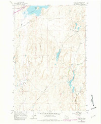
1964 Map of Palm Lake
USGS Topo · Published 1965About this map
Sprague Lake and its prominent Harper Island anchor this mid-1960s landscape, where three major railroad lines converge to shape the local geography. The Northern Pacific, Union Pacific, and Spokane Portland and Seattle railways cut across the terrain, reflecting the area's importance as a transportation corridor between the Washington and Adams county line.
Find a feature on this map
19 named features on this map. Tap any name to fly to it.
Don’t see what you’re looking for? This feature index may not catch every label — zoom into the map to look around manually.
Map Details
Editions of this 1964 Palm Lake Map
2 editions found
Other maps of this area

1953 · Ritzville
USGS Topo · 1:250,000

1954 · Sprague
USGS Topo · 1:62,500

1955 · Spokane
USGS Topo · 1:250,000

1958 · Spokane
USGS Topo · 1:250,000

1959 · Ritzville
USGS Topo · 1:250,000

1964 · Lamont NW
USGS Topo · 1:24,000

1964 · Karakul Hills
USGS Topo · 1:24,000

1964 · Revere
USGS Topo · 1:24,000

1964 · Macall
USGS Topo · 1:24,000

1964 · Marengo
USGS Topo · 1:24,000