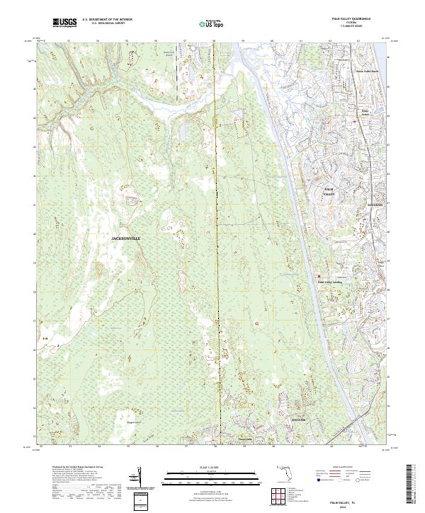
2024 Map of Palm Valley
USGS Topo · Published 2024About this map
The Intracoastal Waterway serves as a central spine for this coastal Florida landscape, separating the inland wetlands from the developed beach communities of the Atlantic shore. Coastal residential growth is concentrated around Ponte Vedra Beach and the planned community of Sawgrass, where a dense network of roads like Ponte Vedra Blvd and a1a follows the coastline. Moving west across the waterway, the terrain shifts into the expansive Cabbage Swamp and Durbin Swamp, punctuated by features such as Powers Bay and Ragged Island. This area reflects a distinct contrast between modern suburban expansion in places like Nocatee and the managed wilderness of the Guana River Wildlife Management Area. Historical landing sites and smaller settlements, including Palm Valley Landing and Twentymile, provide a glimpse into the earlier transit patterns of the Palm Valley region before the intensification of modern development.
Find a feature on this map
138 named features on this map. Tap any name to fly to it.
Don’t see what you’re looking for? This feature index may not catch every label — zoom into the map to look around manually.
Map Details
Editions of this 2024 Palm Valley Map
This is the sole edition of this map. No revisions or reprints were ever made.
Other maps of this area

1917 · Orange Park
USGS Topo · 1:62,500

1918 · Jacksonville
USGS Topo · 1:62,500

1918 · Orange Park
USGS Topo · 1:62,500

1918 · Palm Valley
USGS Topo · 1:62,500

1918 · Mayport
USGS Topo · 1:62,500

1948 · Jacksonville
USGS Topo · 1:250,000

1948 · Jacksonville Beach
USGS Topo · 1:24,000

1949 · Jacksonville Beach
USGS Topo · 1:24,000

1950 · Arlington
USGS Topo · 1:24,000
1952 · Orangedale
USGS Topo · 1:24,000