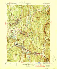
1946 Map of Palmer
USGS Topo · Published 1946About this map
The industrial and transport core of central Massachusetts is defined here by the confluence of the Swift River, Ware River, and Quaboag River, which join near Three Rivers to form the Chicopee River. This 1946 document shows a landscape heavily shaped by rail, where the Boston and Albany RR, Central Vermont Ry, and Boston and Maine RR converge at the town of Palmer. Beyond the main settlement, several mill villages and local hubs like Bondsville, Thorndike, and Baptist Village appear as distinct clusters tied to the river valleys.
Find a feature on this map
50 named features on this map. Tap any name to fly to it.
Don’t see what you’re looking for? This feature index may not catch every label — zoom into the map to look around manually.
Map Details
Editions of this 1946 Palmer Map
4 editions found
Other maps of this area

1887 · Brookfield
USGS Topo · 1:62,500

1887 · Palmer
USGS Topo · 1:62,500

1887 · Belchertown
USGS Topo · 1:62,500

1887 · Barre
USGS Topo · 1:62,500

1889 · Palmer
USGS Topo · 1:62,500

1889 · Barre
USGS Topo · 1:62,500

1890 · Belchertown
USGS Topo · 1:62,500

1890 · Brookfield
USGS Topo · 1:62,500

1893 · Palmer
USGS Topo · 1:62,500

1893 · Belchertown
USGS Topo · 1:62,500