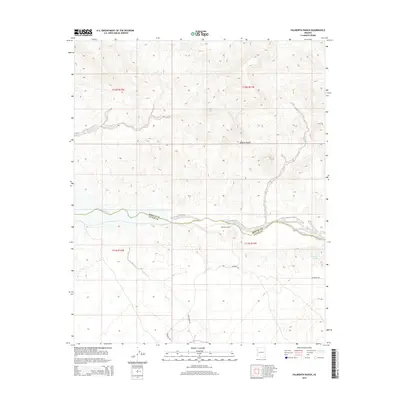
2014 Map of Palmerita Ranch
USGS Topo · Published 2014About this map
Palmerita Ranch sits at the heart of this arid landscape, positioned near the southern bank of the Santa Maria River. The terrain is defined by the stark beauty of the Mojave Desert, where the riverbed serves as a critical corridor between Mohave Co and La Paz Co. Significant desert drainage systems like Valencia Wash and Date Creek carve through the topography, illustrating the complex hydrology of this high-desert region. The presence of Grapevine Springs provides a rare point of reliable water in an otherwise dry environment. Historically, the area is connected by a sparse network of unpaved routes, including Palmerita Rd and Date Creek Rd, which track the contours of the land and provide access to the remote ranching operations and natural springs that have sustained life here for decades.
Find a feature on this map
14 named features on this map. Tap any name to fly to it.
Don’t see what you’re looking for? This feature index may not catch every label — zoom into the map to look around manually.
Map Details
Editions of this 2014 Palmerita Ranch Map
This is the sole edition of this map. No revisions or reprints were ever made.
Other maps of this area

1923 · Signal
USGS Topo · 1:250,000

1942 · Signal
USGS Topo · 1:250,000

1950 · Prescott
USGS Topo · 1:250,000

1954 · Prescott
USGS Topo · 1:250,000

1958 · Prescott
USGS Topo · 1:250,000

1959 · Prescott
USGS Topo · 1:250,000

1960 · Prescott
USGS Topo · 1:250,000

1965 · Prescott
USGS Topo · 1:250,000

1966 · Ives Peak
USGS Topo · 1:62,500

1966 · Artillery Peak
USGS Topo · 1:62,500