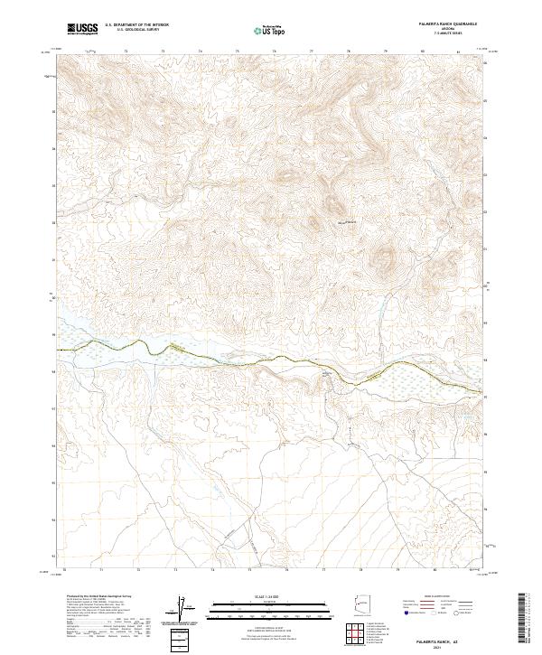
2021 Map of Palmerita Ranch
USGS Topo · Published 2021About this map
The Santa Maria River carves a critical path through this arid stretch of the Mojave Desert, marking the historical boundary between Mohave and La Paz counties. This 2021 survey documents a landscape where seasonal water and ranching history converge. The Palmerita Ranch serves as a primary point of reference, situated near the riverbanks and accessible via Palmerita Rd. These local roads and drainage patterns, such as Valencia Wash and Date Creek, highlight the essential relationship between desert topography and the few reliable water sources like Grapevine Springs. The mapping illustrates how modern township and range lines overlay the traditional river-valley corridors used for desert travel and livestock management.
Find a feature on this map
14 named features on this map. Tap any name to fly to it.
Don’t see what you’re looking for? This feature index may not catch every label — zoom into the map to look around manually.
Map Details
Editions of this 2021 Palmerita Ranch Map
This is the sole edition of this map. No revisions or reprints were ever made.
Other maps of this area

1923 · Signal
USGS Topo · 1:250,000

1942 · Signal
USGS Topo · 1:250,000

1950 · Prescott
USGS Topo · 1:250,000

1954 · Prescott
USGS Topo · 1:250,000

1958 · Prescott
USGS Topo · 1:250,000

1959 · Prescott
USGS Topo · 1:250,000

1960 · Prescott
USGS Topo · 1:250,000

1965 · Prescott
USGS Topo · 1:250,000

1966 · Ives Peak
USGS Topo · 1:62,500

1966 · Artillery Peak
USGS Topo · 1:62,500