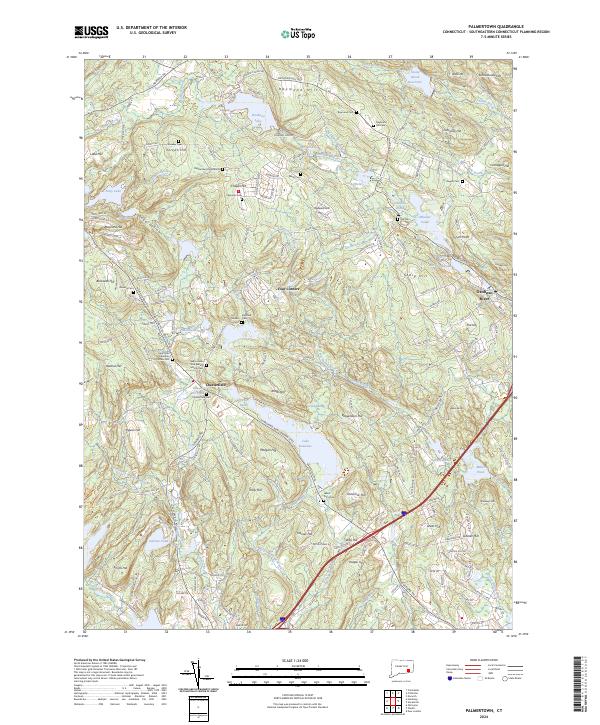
2024 Map of Palmertown
USGS Topo · Published 2024About this map
Chesterfield sits at the heart of this landscape, a settlement defined by its proximity to significant water bodies and numerous burial grounds. The area is dense with historical cemeteries, including the Chester Burying Ground, Chesterfield Cem, and the New London Sick Benefit Society Cem, alongside the Saint John Ukrainian Orthodox Cem. These sites, often situated near family-named landmarks like Raymond Hill and Beckwith Hill, suggest a deeply rooted community history tied to the surrounding terrain.
Find a feature on this map
184 named features on this map. Tap any name to fly to it.
Don’t see what you’re looking for? This feature index may not catch every label — zoom into the map to look around manually.
Map Details
Editions of this 2024 Palmertown Map
This is the sole edition of this map. No revisions or reprints were ever made.
Other maps of this area

1892 · New London
USGS Topo · 1:62,500

1892 · Norwich
USGS Topo · 1:62,500

1892 · Gilead
USGS Topo · 1:62,500

1893 · New London
USGS Topo · 1:62,500

1893 · Saybrook
USGS Topo · 1:62,500

1921 · New London
USGS Topo · 1:62,500

1934 · Niantic
USGS Topo · 1:24,000

1935 · Montville
USGS Topo · 1:24,000

1938 · New London
USGS Topo · 1:31,680

1938 · Niantic
USGS Topo · 1:62,500