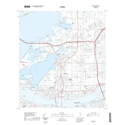
2021 Map of Palmetto
USGS Topo · Published 2021About this map
The Manatee River serves as the southern anchor for this coastal region, where the Green Bridge connects the urban centers of Bradenton and Palmetto. The landscape is a complex network of bays and inlets, including Terra Ceia Bay and Joe Bay, defined by numerous keys and points such as Snead Island and Rattlesnake Key. This area shows a transition from dense residential development in Memphis and Ellenton to the ecologically significant wetlands of the Manatee County Blueway Trail. Notable infrastructure and landmarks include the Thomson Airfield, Mansion Memorial Park, and the distinct small settlements of Rubonia and Gillette to the north. The presence of Bishop Harbor and Kitchen Key highlights the preservation of tidal habitats even as industrial corridors like the Sunshine Skyway and Old US Hwy 41 facilitate regional transit.
Find a feature on this map
82 named features on this map. Tap any name to fly to it.
Don’t see what you’re looking for? This feature index may not catch every label — zoom into the map to look around manually.
Map Details
Editions of this 2021 Palmetto Map
This is the sole edition of this map. No revisions or reprints were ever made.
Other maps of this area

1921 · Fort De Soto
USGS Topo · 1:62,500

1942 · Cockroach Bay
USGS Topo · 1:31,680

1943 · Pass-A-Grille
USGS Topo · 1:31,680

1944 · Anna Maria
USGS Topo · 1:31,680

1944 · Ruskin
USGS Topo · 1:31,680

1944 · Lorraine
USGS Topo · 1:31,680

1944 · Ellenton
USGS Topo · 1:31,680

1944 · Parish
USGS Topo · 1:31,680

1944 · Bradenton Beach
USGS Topo · 1:31,680

1945 · Cockroach Bay
USGS Topo · 1:31,680